Wednesday, July 25, 2012

Standin' On A Corner after being Under the Bridge

Soon after returning to Phoenix with my parents, they headed back east and I hit the road with my new hosts, my brother and new sister-in-law. Debbie had a meeting to attend in Winslow, AZ, and we decided to make a trip of it. As if to remind of the varied and unusual beauty of Arizona's geography, our first stop was the natural bridge in Tonto State Park. Once again, our hike began with a steep descent. After getting an eyeful of the bridge itself, we headed underneath it. As our voices began to echo, a man sitting on one of the smoothly worn rocks beneath the bridge asked us where we were going. His manner suggested knowledge and wisdom, and the echoes added a certain gravity to his voice. It was only after a quick look at the tiny logo on his polo shirt that I realized he was a park employee. I suppose in such a small and popular part of the park, he could let the visitors come to him. He offered some directions and explanations before sending us on our way. As we went, we followed his advice and slid down the rock in front of us. Years of water dripping from the exposed plant roots above had made the surface surprisingly slippery, and those same roots soaked me in the closest thing to rain I had experienced in Arizona.

After camping near Blue Ridge Reservoir, we made the drive in to Winslow for the meeting. Jesse and I dropped Debbie off and then attempted to occupy ourselves for a day in Winslow. It was not easy. Both of us were titillated by being in the same town mentioned by The Eagles in "Take It Easy." Before leaving, we learned that Winslow has a park dedicated to the line "standin' on a corner in Winslow, Arizona." Once there, we found that park to be the highlight of our visit. It seems that the construction of I-40 bypassed Winslow and made it redundant. While it is still a hub for freight train traffic, its main street is a place where shop doors slam in the wind and logos of previous owners remain emblazoned on empty storefronts.

There is one ray of hope, however: new owners are renovating La Posada, an old hotel from the town's heyday as a passenger rail stop. Not much of an architecture connoisseur, I was expecting to lose interest quickly, but they have done a good job of making it comfortable, even for non-paying guests. Especially intriguing was the common room, an amenity forgotten in modern hotels. Rather than encourage guests to use the hotel only as a place to sleep and eat, La Posada attempts to make its guests feel at home. While this effort is at least partly motivated by the original plans of the hotel, it is clear that there is very little to do in Winslow, and encouraging guests to stay in may be the hotel's only hope of succeeding.

We returned to Phoenix via Flagstaff, where we stopped for a brief hike to get one last feel of the cooler weather before returning to the desert. Before long we were back in the triple digits (Fahrenheit) and heading to bed after a busy couple of days.

Prickly pear cactus.

Jesse staring at the crayfish.

"Rain" from the plant roots.

Standin' on a corner is all well and good...

...but make sure you stand at the right one. This is the next block.

Outside La Posada.

Tuesday, July 17, 2012

Describing the Indescribable


There are several places around the world that defy description. The Grand Canyon is one such place. To describe its sheer awesomeness – that's “awesome” in the literal sense of creating awe – is impossible with mere words. In fact, it is one of those destinations that so many people rave about, it's possible to take it for granted and lose interest in actually seeing the place. I have to confess, I had reached that point when I went to Arizona. The Grand Canyon was, to me, an amazing place that other people had told me about. While I would not have said no to a free trip there, I wasn't dying to see it either. In retrospect, I should have made it my top priority. Fortunately, my parents made it theirs.

After spending the night in Williams, on Route 66, we reached the entrance of Grand Canyon National Park at around 9 the following morning. Once inside, we parked and took our first look at one of the most unique and impressive sights I have ever seen. The Grand Canyon ranges from 4 to 18 miles wide (6-29 kilometers), carved out of sandstone by the Colorado River. But the basics of its geography only give a rough impression of its grandeur. From the South Rim, where the majority of visitors go, it is rarely possible to see the Colorado River itself. Not only is it miles away as the crow flies, it is also one mile down. In between the rim and the river, and continuing beyond to the North Rim is a series of colors and shapes for which the word “magnificent” is insufficient.

The Grand Canyon is big enough to keep even the most avid outdoorsperson entertained for weeks. We only had a day. It is very easy to get overly ambitious when hiking around the Grand Canyon, because it is deceptively vast and visually stunning. Furthermore, hiking into a canyon means the return journey is uphill, so the early stages will seem easy while the most difficult stages are at the end. And with the extreme weather common in the area – the Grand Canyon is at a high elevation and a long way from the mediating influence of the ocean – horror stories abound of hikers with more ambition than supplies who wound up as buzzard food. But I must give credit to the National Parks Service, who do a fantastic job of explaining the facts and reminding visitors not to be stupid (but in slightly nicer words). Keen not to become horror stories ourselves, we limited our walk to the first rest stop, where we could refill our water bottles and listen to other hikers talk about their journeys. While we sweated buckets in the 85°F heat, people passed us on their way out from Phantom Ranch, which is at the river. It had been 125°F down there.

Once we had gotten a taste of the canyon, we spent the rest of the day walking along the rim. No matter how tired we became or how crammed the free shuttle buses were, annoyance and frustration dissipated at the fantastic sight that dominated the landscape. As evening set in, we made our way back to Williams via Flagstaff. Although we passed through some strange and unique territory – we weren't far from the Painted Desert and Hopi country – nothing could shake my mind from the Grand Canyon. It was a staggering sight. 

Note the people on the left.


Impromptu hiking outfit - Lawrence of Arabia handkerchief and a gallon of water.

One example of the NPS's warnings.


Tuesday, July 10, 2012

Wedding and Wanderings


Although I was returning to the country of my birth, once I boarded the plane at Auckland airport, every place I saw in the next three weeks was new to me. My flights went through Sydney and Los Angeles on the way to Phoenix, where my brother was getting married. Although flying does not give a person a great sense of a place – part of the reason I prefer to avoid it whenever possible – I was surrounded by new opportunities for exploration despite the fact that I was “going home.” As far as the flights are concerned, I'll avoid the details and say it was a long but smooth journey, largely thanks to the fantastic in-flight entertainment offered by Qantas airlines. It also didn't hurt that I had an empty seat next to me for the 15-hour odyssey between Sydney and Los Angeles.

My individual travels have taken me around Western Europe, Scandinavia, and now New Zealand. As a child, my family travelled by car around large parts of North America, but the southwestern United States have always eluded me. As I flew into Phoenix, enjoying a brief flight after surviving the long haul from Sydney, I looked out the window to see a mountainous desert. The desert I had expected – the mountains were a surprise. Just as I might have on a family trip in days gone by, I asked my dad about Arizona's bumpy landscape. He replied that there are mountains everywhere in the West, and that it's almost unfair how much scenic beauty there is in this part of the country as compared to the East. (Dad's from Ohio, where bends in the road are a shock.)

I obviously wanted to spend time with my family while in Arizona, and fortunately they shared my interest in exploring this unique part of the country. After a successful wedding without major breakdowns and with plenty of happiness, my parents and I made the trip out of the sauna-hot Sonoran Desert up to the Grand Canyon. Along the way, the elevation increased by almost 6000 feet (1800 meters), taking me higher than the top of Avalanche Peak in Arthur's Pass. Needless to say, the landscape changed dramatically as we climbed.

Leaving Phoenix seemed to take longer than it should. My family is from the more densely settled eastern part of North America. From what I've heard about Los Angeles, Phoenix is not the most extreme example of urban sprawl – but from what I saw there, it can't be far off. We are also accustomed to cold winters, and only hear of Arizona as a place where people go to avoid them. So watching miles of hot, scrubby, saguaro-covered desert pass by the car windows was a tiring process. We had begun to wonder about the merits of scenic routes when the climb began in earnest. Route 89 climbs 2500 feet in four miles up Yarnell Hill. In my home state of Massachusetts, that's two-thirds of the elevation of the state's highest mountain. In Arizona, it's a bump. Our doubts about scenic routes had evaporated.

Once safely out of the heat, we took a lunch break in Prescott. While still very dry and dusty, Prescott has more trees and thus, more shade. We had already done more than half of the climb up to the elevation of the Grand Canyon, and although shorts and t-shirts were still comfortable in the sun, the wind could make things very chilly.

When we left Prescott, we climbed through the mountains to Jerome, a small mining town built onto a cliffside. In many ways, it reminded me of Cazorla,Spain – the streets were steep and always ended in hairpin turns. Indeed, the sign announcing Jerome Town Limits was on a hairpin itself, making it appear as though the town was somewhere in midair. We could only stay for long enough to take a few photos, as we had a dinner date with my aunt and uncle, who had gone up to Sedona after the wedding.

Almost every one of my family members who came to Arizona for the wedding took advantage of being there to do some extra travelling, which made for a lot of talk about places to visit. Even though we had talked about Sedona, I somehow failed to realize that it was home to Red Rock State Park. The drive into Sedona was one of the biggest surprises of the trip for me – I had been falling asleep in the front seat when I started noticing giant sandstone formations, which held my attention for as long as we were there. Although the town itself has built its economy on tourism, I can't blame them. I like going “off the beaten track” when it comes to travelling, but the Red Rocks are one very good reason why the beaten track goes where it does.

The variety of the natural landscape and climate had already impressed me more than I had imagined it would, and we hadn't even reached the Grand Canyon yet. 

Looking back on Phoenix from Piestawa Peak.

Piestawa Peak, looking away from Phoenix.

Jerome, AZ.

Red Rocks in Sedona.


Tuesday, July 3, 2012

Bringin' it Back Home (for a bit)


It was about the time of this post, as I was passing through Christchurch for the first time, that I received one of the most important phone calls I will ever hear: my brother had asked his girlfriend to marry him, and she had said yes. Aside from the obvious excitement, this meant planning a return to North America sooner rather than later. In early May, I wrapped up work in Arthur's Pass with plans to return, and headed off to Auckland to fly back across the Pacific.

But Auckland is a long way from Arthur's Pass, and I was not tempted to add one more flight to an already arduous itinerary. So when I came down from the mountains, the wedding was still two weeks off and I was on my way to Hanmer Springs, Kaikoura, and Wellington.

Hanmer Springs is nestled in the Southern Alps about four hours north of Arthur's Pass by road. I hadn't heard much about it before I went, but I knew it had hot springs and that was enough to draw me in for a day or two. What I did not realize is how much of a resort town it is. Popularized as an alpine retreat, it is a pretty common getaway for those Cantabrians who can afford it, as evidenced by the quantity of families I saw there. Coming by myself from Arthur's Pass, where five people are a crowd, I didn't mind being around some extra people. But being surrounded by visitors made the place feel a bit disposable. While at one of the bars watching rugby, a group of young women in costumes arrived. I exchanged guesses with the people I was chatting to about the occasion – bachelorette party was the consensus – and then learned it was a local girls' night out. The idea of “locals” in Hanmer Springs had never even crossed my mind. It's a place that thrives on short visits, which, in retrospect, makes me feel normal.

Kaikoura is a place I was far more excited about visiting, and with nothing holding me in Hanmer – not even one of the costumed locals – I hitched my way there fairly quickly. I had passed through on the train in November, but I had heard far too many good things about it to be satisfied with a glimpse out the window. Its location alone is a marvel: the Kaikoura ranges are almost directly on top of the Pacific Ocean and the ocean floor, so I'm told, drops quickly from the Kaikoura peninsula, creating a fruitful habitat and an eco-tourist magnet. I was lucky enough to be there during the slow season, when there are fewer tour buses and ample hostel beds available.

Despite living on an island, it had been a while since I'd seen the ocean, and I was eager to walk around the Kaikoura Peninsula. I was also lucky enough to do so on a sunny day. As I headed out along the peninsular road, the number of houses steadily dropped and the amount of wildlife increased. There is a well-advertised seal colony near the end of the peninsula, but before 
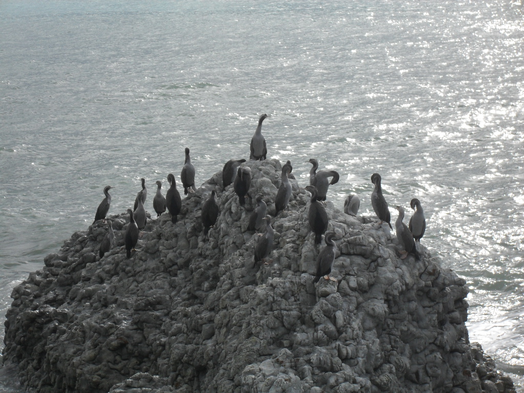
I was halfway there, I had already seen a colony of Hutton's shearwaters, a seabird that is endemic to New Zealand – in fact, endemic to the Kaikoura region. Once the town had been left behind a turn, I passed remnants of old whaling stations before reaching a boardwalk along the shore, leading to the seal colony. There had already been signs warning pedestrians to keep a safe distance from the seals, but I was surprised to find that the seals did not obey them. Had I not been on a boardwalk, I might have trodden on one as it lay in the bush along the shoreline.

The seal colony was the end of the road, so I continued on the trail which went up to the cliffs above, overlooking the ocean. Once again, I decided that I will need to create new words for “scenic,” because the view was staggering. Looking down from above on the clear water allowed me to get a sense of the ocean floor that I had read about, and gave me a view of a seal colony that is not advertised. I could see rain coming on, however, and did not stop to enjoy the view for too long.

The following morning, I hitched out of Kaikoura after a long walk to the edge of town, and made my way to Picton. I stayed there for the night and caught an early ferry to Wellington, where I stayed for five days, catching up with friends and running some errands. Before long, I was on a bus to Auckland, where I began my long series of flights back to the United States. 

Hanmer Springs.

The backdrop of Hanmer Springs.

Kaikoura, with the Kaikoura Ranges in the distance.

Hutton's shearwaters.

A seal, pondering a swim.

A seal, within the "safe distance."

Another seal colony, from above.

Looking south from the Kaikoura peninsula.